Author Archives: Ray
Totally out of order, but the January Gowanus Grassroot Mapping pictures
On a freezing 11 degree day, (January 22, 2011 to be precise) the Gowanus Grassroot Mapping crew hiked out to Gowanus Canal to document the Superfund site. These balloons were made out of Mylar emergency blankets, and filled with helium … Continue reading
More grassroots mapping on the Gowanus…
I’m admittedly way behind on my grassroots mapping updates… but here some more photos from our grassroots mapping excursions. In our March 27th excursion, we also got immensely helpful assistance from Charles Stewart, who is a kite enthusiast / expert … Continue reading
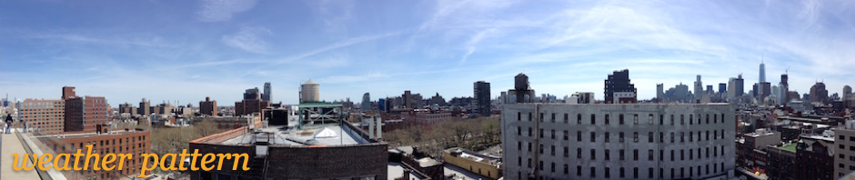
What I did today: Grassroots Mapping
Today, I worked with Jeff Warren, long time friend Liz Barry, and students from Parsons and the New School on Grassroots Mapping. With what amounts to DIY Satellite Imaging, a camera was attached to Mylar balloons, which was tied to … Continue reading
Posted in design, map, Uncategorized
Comments Off on What I did today: Grassroots Mapping
People are people…
A couple of interesting articles appeared on nytimes.com today about the future of human. Although, insights and important discoveries have been made, Nicholas Wade reports in “A Decade Later, Genetic Map Yields Few New Cures,” that ten years after completing … Continue reading
Posted in book, ethics of design, innovation
Comments Off on People are people…
8-bit + Interactive Map of NYC = <3
Brett Camper made a wonderful interactive map of New York with 8-bit graphics. http://8bitnyc.com/ (Thanks Vanessa!)
Posted in computation, design, map
Comments Off on 8-bit + Interactive Map of NYC = <3
US Census Maps Participation Results
I hope that everyone’s mailed back their 2010 US Census forms, which are due April 1, National Census Day. While it’s a rather arcane approach to studying people’s location, it is still important because of its scale, use to allocate … Continue reading
Posted in design, information, map
Comments Off on US Census Maps Participation Results
A Decade of Photos
As the journalism and news industry continues to churn and find its way to a sustainable future, the New York Times made an open call to its readers to submit their photographs with captions to document the last decade in … Continue reading
Posted in culture, information, publishing
Comments Off on A Decade of Photos
Yet another amusing xkcd on Research and Innovation
Another great entry by xkcd, this time on research and innovation. With the all the trends of 2010 lists floating about, it’s nice to keep the obsession with the new in check.
Posted in innovation
Comments Off on Yet another amusing xkcd on Research and Innovation
Museum of the Phantom City Redux
The fine folks at Urban Omnibus and WNYC are hosting a meet up at Bryant Park this Saturday to explore New York’s unbuilt future from the past with the project I worked on: Museum of the Phantom City. Details below… … Continue reading
Posted in design, map, networks, social networks, telecommunications
Comments Off on Museum of the Phantom City Redux
Launched… Museum of the Phantom City
The Museum of the Phantom City launched, which invites people to interact with unbuilt architectural proposals through an iPhone app and website. The project plays with some interesting ideas about location (obviously) but also of how designers in the past … Continue reading